Amrita’s disaster risk management approach is grounded in applied research and driven by a strong social conscience, across pre-disaster, disaster and post-disaster scenarios.
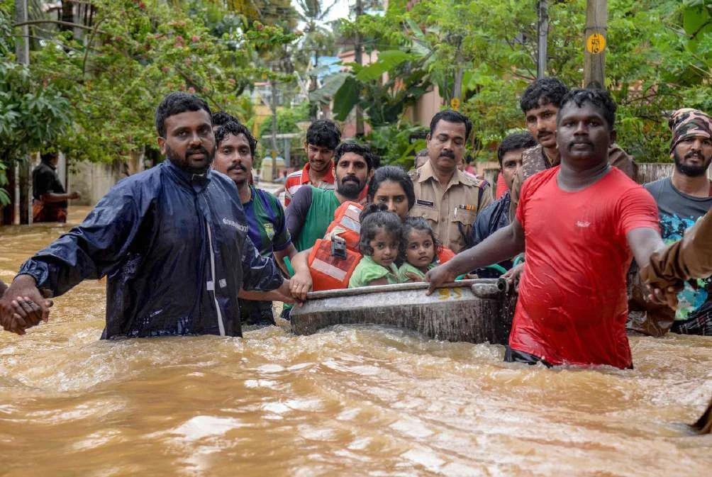
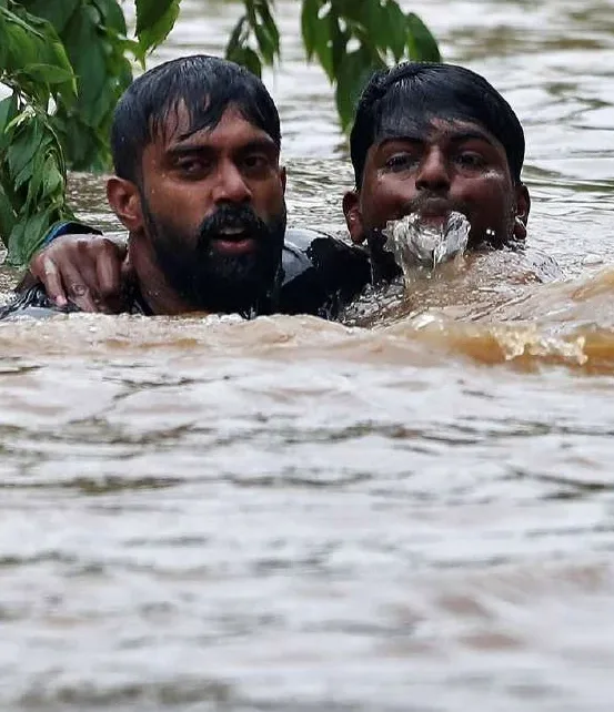
Kerala floods 2018 · relief and rescue
1 Million+
Beneficiaries impacted
25
States
2,200+
Communities
300+
Community projects
Flood monitoring & mitigation
Forecasting floods, mapping them with citizens
Kerala floods, 2018.
Flood EWS · Himalaya
Seven days of lead time
A hydrological modelling framework for the Beas and Sunkoshi rivers forecasts flooding up to 7 days ahead. A physics-aware machine-learning model produces an ensemble of river-flow simulations and minimises forecasting error.
FloodEvac · Indo-German
Crowd-sourced urban flood monitoring
Smartphone reports, computer-vision depth estimates from known objects such as bridges, lamp-posts and vehicles, and a coordination suite linking government, NGOs and volunteers produce spatio-temporal flood-intensity maps for relief.
Trento collaboration
Munnar floodplain mapping, Kerala 2018
Back-analysis of the August 2018 disaster combined hydraulic modelling, river geometry mapping, surface velocity and bathymetry. Rating-curve and HEC-RAS discharge estimates converged at about 630 to 1,016 m³/s.
AI flood-extent detection from crowd-sourced images
84.24% classification accuracy (Geetha et al., ICCSP 2017)
CaptureSmartphone images
SegmentColour-based water isolation
ReferenceHumans & structures as scale
EstimateDepth + extent
MapSpatio-temporal intensity
Hydroclimatic extremes in a changing climate
Cloudbursts, droughts and shifting rainfall
Research into precipitation shifts, extreme rainfall including cloudbursts, drought development and compound drought-heatwave events, using machine learning and deep learning to improve prediction and climate risk assessment.
Asia-Pacific Network for Global Change Research
Enhancing climate resilience in South Asia and China
Predicting precipitation shifts and their impacts for disaster risk reduction and resource security. The project aims to:
Understand changing precipitation patterns and phase transitions
Enhance climate resilience through knowledge, information and capacity building
Develop strategies to mitigate extreme weather and promote water, food and energy security
Consortium partners
The Small Earth NepalTribhuvan University, NepalJigme Namgyel Engineering College, Royal University of BhutanChinese Academy of Sciences, ChinaSher-e-Bangla Agricultural University, BangladeshNagoya University, JapanThe Islamia University of Bahawalpur, PakistanCity College of New York, USAUniversity of Rhode Island, USAUniversity of Nevada, Reno
Extended-range forecasting
Daily rainfall, 10 to 30 days ahead
Satellite, in-situ, reanalysis and numerical weather prediction data, with temperature, humidity, wind and sea surface temperature, capture drivers such as monsoon variability and the Madden-Julian Oscillation. Statistical and machine-learning fusion improves reliability for early warning and climate-sensitive decisions.
Born from the Kerala floods and Uttarakhand flash floods. 21+ multi-rotor VTOL configurations tested across endurance and payload regimes; indigenous, scalable design for state-level deployment, co-developed with State Disaster Management Authority experts.
24×7 helpline · Kerala floods 2018
Compassionate Call Center
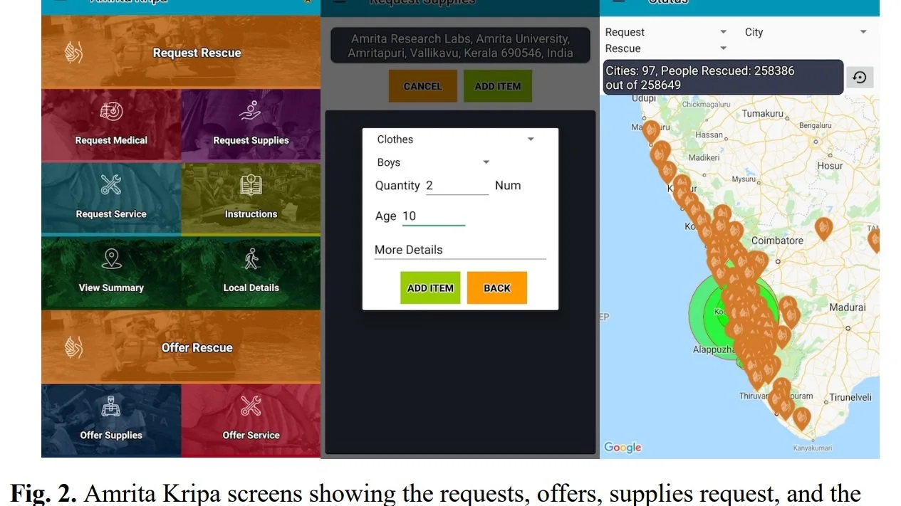
Within 5 days the team fielded 25,000+ calls and connected 100,000+ flood victims to government, Navy, NDRF, Kerala State Police, fishermen and volunteer agencies. 400+ AYUDH Amritapuri volunteers worked across three shifts.
Oceans & coast
OceanNet: affordable marine internet for all
Up to 60 km of offshore connectivity reduces casualties caused by communication failure during emergencies.
A hierarchical point-to-multipoint long-range Wi-Fi backhaul links onshore base stations with low-cost receiver-broadcaster units on fishing vessels. A boat-to-boat hopping mode extends the signal far beyond the shoreline.
Communication infrastructure within the OceanNet Digital Ecosystem (ODE)
Sea-state, weather and disaster alerts delivered to fishing vessels
Direct INCOIS feeds: Potential Fishing Zones, high-sea-wave alerts, weather forecasts and surface-temperature updates
Real-time tracking and localisation for SOS calls
Emerging · 2024 to 2026
Maritime Artificial IoT & OceanNet Blockchain
Extends OceanNet into a knowledge ecosystem: sustainable fish-catch information, ocean-emergency warnings, pollution monitoring, wave-height and acidification observation. Blockchain adds decentralisation, transparency and data immutability, addressing five core livelihood issues for fisherfolk.
Coastal erosion · Alappad, Kerala
Shoreline change on a sand-mining coast
Remote sensing, field data and geospatial modelling reveal interactions between coastal processes and human activity, informing Tsunami Ready preparedness (Satish & Geetha, ICECCT 2021).
Ocean observatory
Acidification monitoring
Static nodes and a modified Ferrybox on ships of opportunity feed a delay-tolerant wireless network. Cloud-stored pCO₂, pH, temperature, salinity and pressure inform tropical-estuary biogeochemistry.
Community resilience · 2004 Indian Ocean Tsunami
Alappad: from devastation to resilience
On 26 December 2004, a 9.1-magnitude earthquake off Sumatra unleashed a tsunami that claimed over 230,000 lives across 14 countries. Alappad, a narrow coastal island in Kerala and Amma’s birthplace, lost 142 lives, and thousands of homes, boats and livelihoods.
Within 45 minutes of the first wave, Amma evacuated 3,000 people, and ultimately 20,000 survivors were ferried to safety by boat.
7 millionMeals over five months
6,400Tsunami-resilient homes, four states and Sri Lanka
700Fishing boats distributed
900Students supported
The Amrita Setu evacuation bridge was built, transforming a devastated community into one more resilient than before the disaster.
Mitigation
Protect & mitigate
Tsunami-resistant houses, nature-based and indigenous solutions, livelihood diversification.
Preparedness
Prepare & plan
Early warning, horizon scanning, situation awareness and risk communication.
Response
React & cope
Mass evacuation, timely medical care, safety, calm and hope.
Recovery
Rebuild & bounce forward
Healing trauma, youth empowerment, skill training, quality education and social connectedness.
Climate, ecosystems & community adaptation
From carbon flux to co-designed farming
Remote sensing
Wetland carbon · Ashtamudi Lake
Sentinel-5P TROPOMI and Sentinel-2 imagery quantify CO and CH₄ emissions across Kerala’s Ramsar-listed estuary, yielding emission-flux models tuned for tropical estuaries.
Biodiversity
Mangrove mapping · Kollam
Landsat time-series, field spectra and biomass data deliver species-level maps of coastal mangroves, with a transferable method for long-term monitoring.
International
Global methane flux · CH4DAS
A methane data-assimilation system using in-situ and satellite observations, co-developed with the Superpower Institute (Australia) and LSCE (Paris), produces an improved global flux map for wetland emissions.
Sadivayal village, Coimbatore
Sustainable farming, co-designed with farmers
In Sadivayal, 70% of rice farmland is left fallow each year. Three strategies were co-designed: early sowing to reduce terminal drought; supplemental irrigation to stabilise yields; and switching from rice to sorghum or maize, which cut irrigation needs by up to 90%.
70%Rice farmland left fallow
90%Irrigation cut via crop switching
03SDGs directly addressed
Co-designParticipatory approach
Cauvery watershed
Soil erosion under climate change
Quantifying climate-change impact on soil erosion with the Revised Universal Soil Loss Equation (RUSLE), with sustainable mitigation strategies for affected communities.
Empowering communities
Preparedness, livelihoods and resource centres
Launched June 2022
Tsunami Ready
Amrita with IOC-UNESCO and INCOIS. A community-performance-based programme engaging the public, leaders and emergency agencies. Alappad is the first launched site, with adjacent coastal regions next.
Skill acquisition
SANKALP
Has trained 4,500+ Self-Help Group members across 9 states: Kerala, Tamil Nadu, Odisha, Uttar Pradesh, Gujarat, Rajasthan, Haryana, Uttarakhand and Himachal Pradesh, including transgender SHG cohorts and other minority groups.
Since 2006
AmritaSREE Self-Help Groups
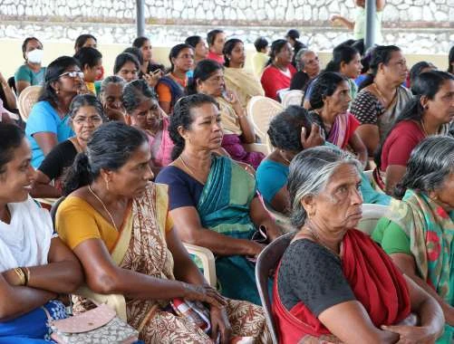
Launched by Amma to build climate-resilient communities. 300,000+ women access vocational education, start-up capital, microcredit and microsavings to run cottage industries that buffer climate shocks.
Community Resilience Resource Centres (CRRC)
14Hubs
200Spokes
300+Projects
HealthLivelihood & skillEducationAgricultureWater
Featured research · community preparedness
Empirical study of women’s SHGs for tsunami readiness, Alappad
SREE dashboard for sustainability and resilience in community engagement
Community resilience · Kerala floods 2018
The worst floods in 100 years
Within five days of the Amrita Kripa launch, the team logged 3,000+ entries in real time, fielded 25,000+ helpline calls and connected 100,000+ flood victims with rescue and relief services across Kerala.
Amrita Vishwa Vidyapeetham
Explore all of Amrita’s research
Read the full Disaster Risk Reduction & Community Resilience brochure, or visit the university site.