01
Integrated visualisation
Real-time satellite and weather feeds; live regional hazard inventories.
 FOR MOTHER EARTHAmrita landslide research
Innovations
On top of the sensor network, Amrita built regional warning platforms, an indigenous AI for climate risk, and apps that put communities in the loop.
Amrita Kavach
Powered by artificial intelligence, social data mining, geoinformatics and satellite products.
01
Real-time satellite and weather feeds; live regional hazard inventories.
02
Automated susceptibility analysis; dynamic risk heatmaps.
03
Real-time rainfall thresholds; analysis of antecedent conditions.
04
Preparedness and routing tools; response and evacuation analysis.
AmritaKripa
Integrating GLOF, landslide, flood and cyclone signals into a single decision-support framework.
Rainfall triggers
GPM IMERG and rain-gauge fusion; multiple thresholds.
Landslide
Site-specific and regional rainfall thresholds.
GLOF
Glacial-lake monitoring, bathymetry and velocity profiling.
Flooding
Hydrological models and 7-day ensemble forecasts.
Cyclone-induced
Cyclone, rainfall and terrain coupling for slope stability.
Why it matters
Cascading hazards rarely arrive alone. A unified framework couples signals across domains, sharpens thresholds and turns a sequence of events into a single warning.
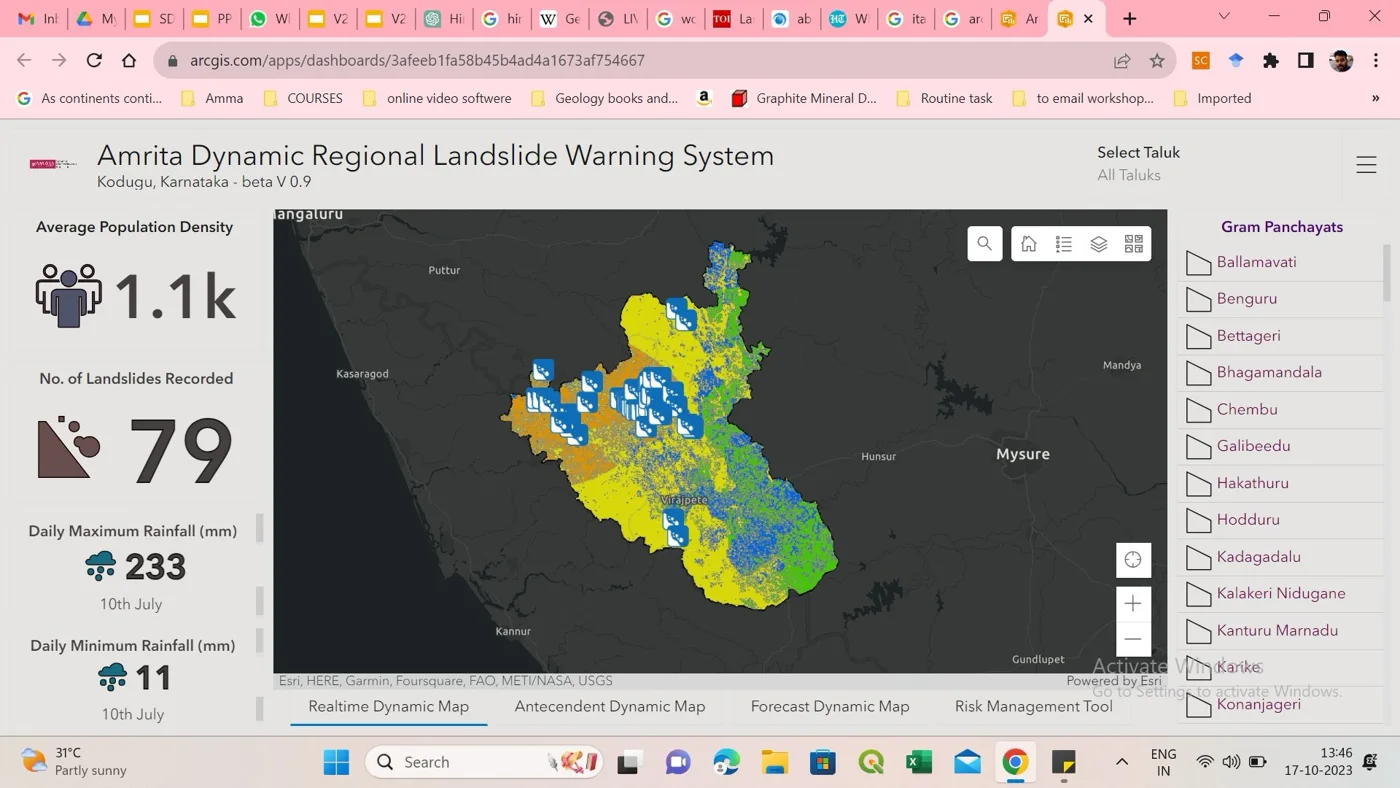
Real-time risk dashboard · Karnataka
An operational ArcGIS dashboard developed jointly with the Karnataka State Natural Disaster Monitoring Centre. It shows risk evolving at sub-district scale, alongside automated bulletins, evacuation protocols and risk communication.
Scientific outputs become actionable inputs for the District Magistrate and emergency response teams.
Apps & citizen science
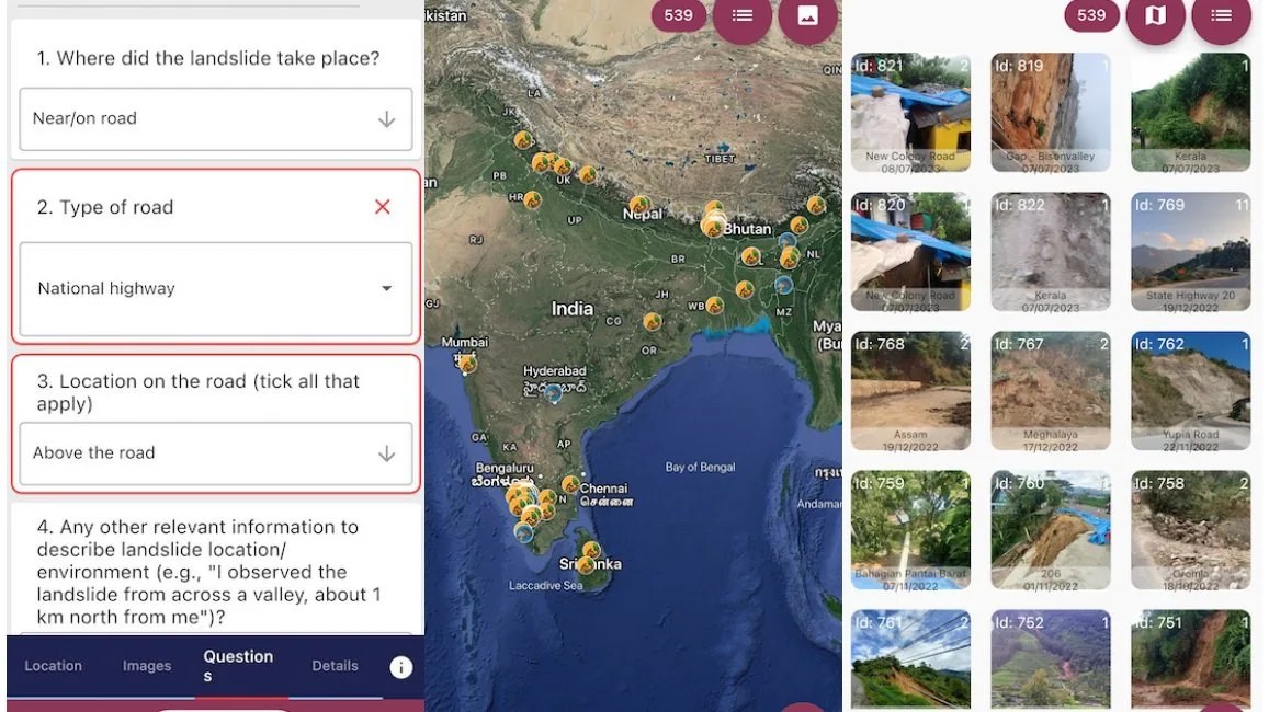
Landslide Tracker App
A multi-level app for spatio-temporal crowd-sourced landslide reporting that complements sensor data.
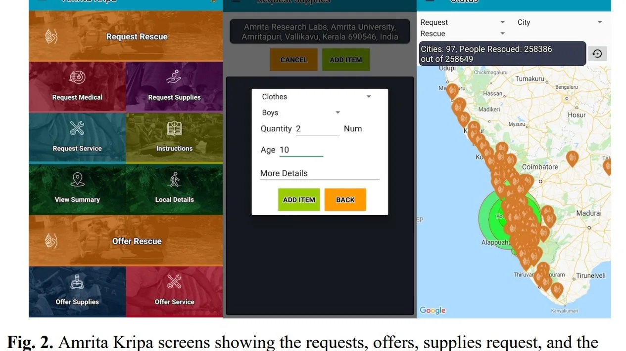
Amrita Kripa app
Links survivors, relief camps, rescue teams, NGOs, volunteers and administrators. In the 2018 Kerala floods, the worst in 100 years, it ran in parallel with the wireless landslide-detection network and the 24×7 Compassionate Kerala Call Centre.
People rescued
Requests logged
Call-centre linkages
Languages
Amrita Kripa app figures as reported in the brochure.
Social media in risk assessment
Within the LANDSLIP consortium, Amrita leads work on bringing social media data into multi-hazard risk assessment, and on improving forecast reliability for hydrologically controlled landslides.