Amrita Vishwa Vidyapeetham FOR MOTHER EARTHAmrita landslide research

Site investigations · mega disasters

Evidence from
India’s worst events

Amrita teams go where landslides and cascading disasters strike, and bring back the evidence that shapes the next warning.

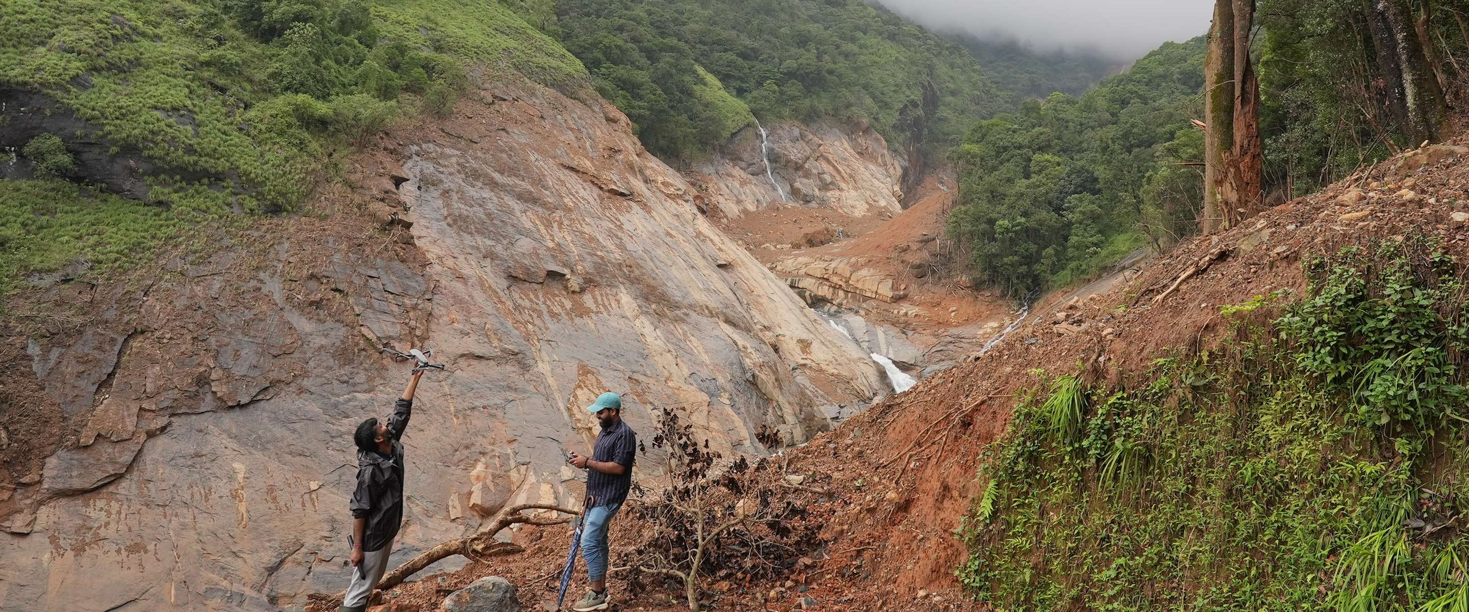
Amrita researchers launching a survey drone beside a landslide-scoured rock face and debris channel
Drone survey of a landslide channel · Amrita research team
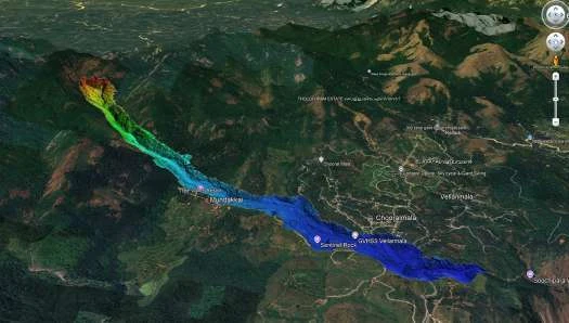
3D terrain view of the Wayanad debris flow path

Wayanad, Western Ghats · 30 July 2024

A 6 km cascade of landslide, debris flow and flood

~572 mmRain in 48 hours
6 kmCascading event

Amrita’s response combined GPM IMERG satellite rainfall, KSDMA/IMD rain-gauge data, ERT investigation of the water table and SRT bedrock surveys. Trigger analysis applied Caine (1980) thresholds with regional rainfall accumulation models.

The lesson: treating each hazard in a separate silo would have missed the chain.
48,500 m³/sPeak discharge, South Lhonak GLOF

North Sikkim · October 2023

South Lhonak glacial lake outburst

473 km²Lachen Valley devastated
1.6 kmLake-length growth
0.027 km²Average yearly expansion

Intense rainfall triggered an ice avalanche that breached the terminal moraine. The flash flood ran down the Teesta River and destroyed the Chungthang (Teesta III) Dam.

Building on a 2013 Current Science study by Dr Remya S. N., researchers analysed Landsat 5/7 imagery from the 1990s to 2022 and CORONA data. Graph-based hazard-network analysis confirmed dam collapse and downstream flooding as the highest-risk nodes (Ekkirala & Ramesh, Scientific Reports, 2026).

3 sitesChamoli · Joshimath · Tapovan

Uttarakhand

Chamoli glacier break, Joshimath subsidence, Tapovan barrage

Multi-directional cracking, road subsidence and barrage damage were documented across the three sites.

The findings inform future Himalayan early warning deployments and dynamic risk maps that combine geological, hydrological and human stress factors.

Sub-basin GHighest-risk zone, Tirumala Hills

Tirumala Hills, Andhra Pradesh · 2021 extreme rainfall

Rockfall and landslide vulnerability, catchment by catchment

By analysing sub-basins, drainage patterns and geology, researchers identified high-risk zones, especially sub-basin G. The study shows how geology and human activity combine, and offers a systematic framework for hazard assessment and mitigation planning.

Read in Publications →
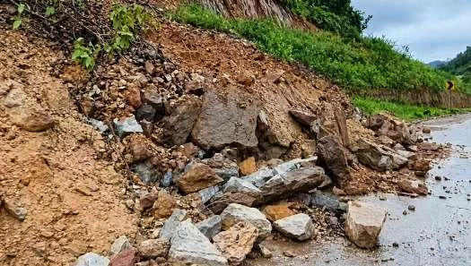
Rockfall debris beside a road in Odisha

Gajapati, Odisha · cyclone-induced landslides

When cyclones bring slopes down

20Villages destroyed by Cyclone Titli, 2018
48Fatalities

The research goal is an AI-driven early warning system that integrates real-time and historical rainfall, soil and terrain analysis, and machine-learning prediction, targeting the coupling between cyclones, rainfall and slope stability on India’s east coast.

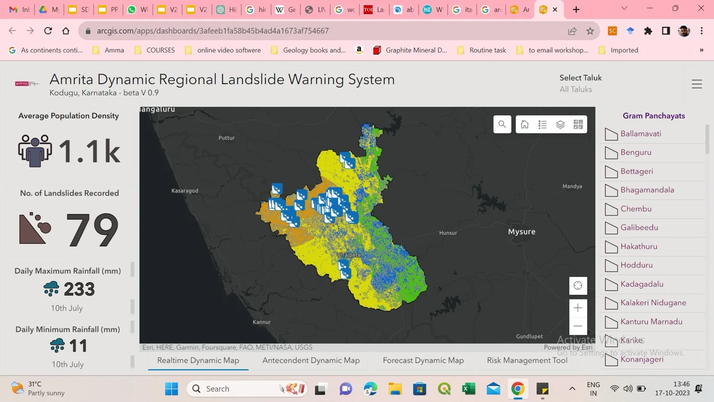
Dynamic regional landslide warning dashboard for Kodagu

Kodagu, Karnataka · MoU 2023

Dynamic maps that predict landslides in real time

With the Karnataka State Natural Disaster Monitoring Centre, researchers developed and rigorously tested rainfall-threshold-driven dynamic landslide maps. They predict and monitor real-time landslide occurrence across the Kodagu region, a markedly more precise approach to forecasting.

Source: Amrita Vishwa Vidyapeetham, Disaster Risk Reduction & Community Resilience 2026, pages 11 to 15.